Coming across the cowboy and his two horses, I knew I had to take their picture. Set against the upright backdrop of the Klickton Divide, on the boundary marker of the Yakima Indian Reservation, my hiking partners and I met the equestrian group as they were enjoying the view.

The cowboy didn’t mind his picture being taken, neither did the horses I suppose, and their photo would eventually land me second place in the Equestrian Category of the 2017 PCTA Photo Contest. After four months of daily hiking on the Pacific Crest Trail (PCT), the route never failed to provide something new to appreciate. Little did we know at that moment though, standing next to our cowboy gate-greeter who had just come from the other way, this was just the beginning of the most beautiful stretch of trail on the entire PCT.
“Ya’ll have yourself a good time,” our cowboy companion tipped his Stetson our way.
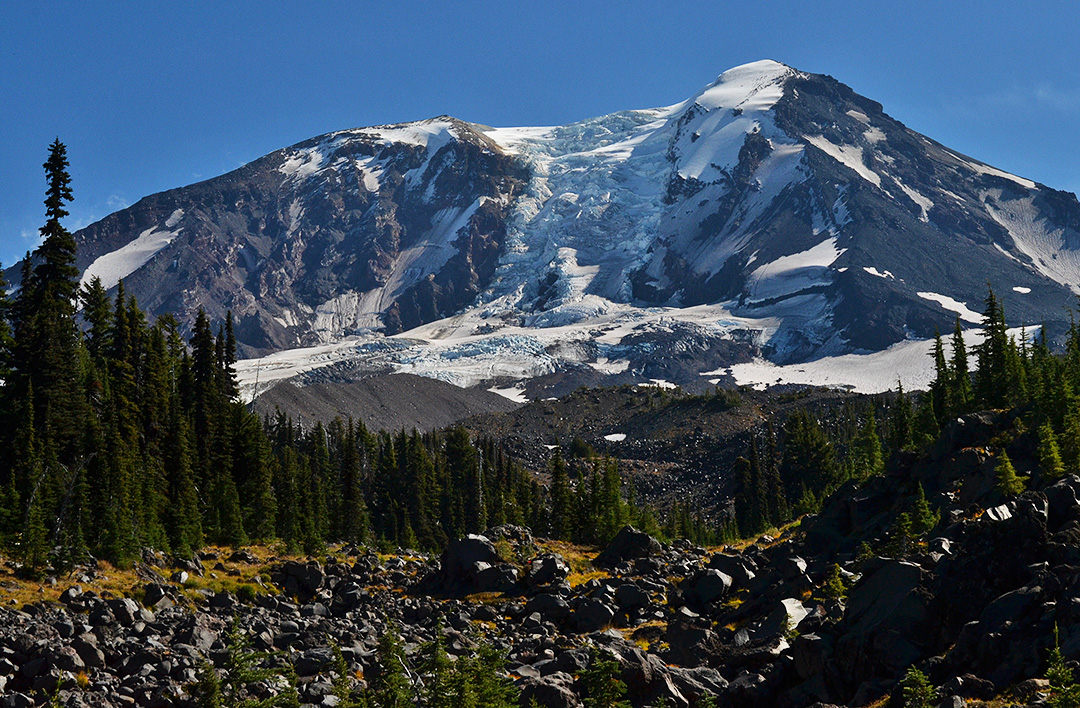
We awoke early that same morning not to the usual programed alarm clock of the rising sun, but instead by the guttural mating call of a bull elk somewhere nearby. Not exactly a soothing start to the day, spirits were high nonetheless. The 20+ mile day previous had us navigating the glacier-blue base of Mount Adams, and despite the sounds of serenading before sun break, we woke up still riding yesterday’s high.
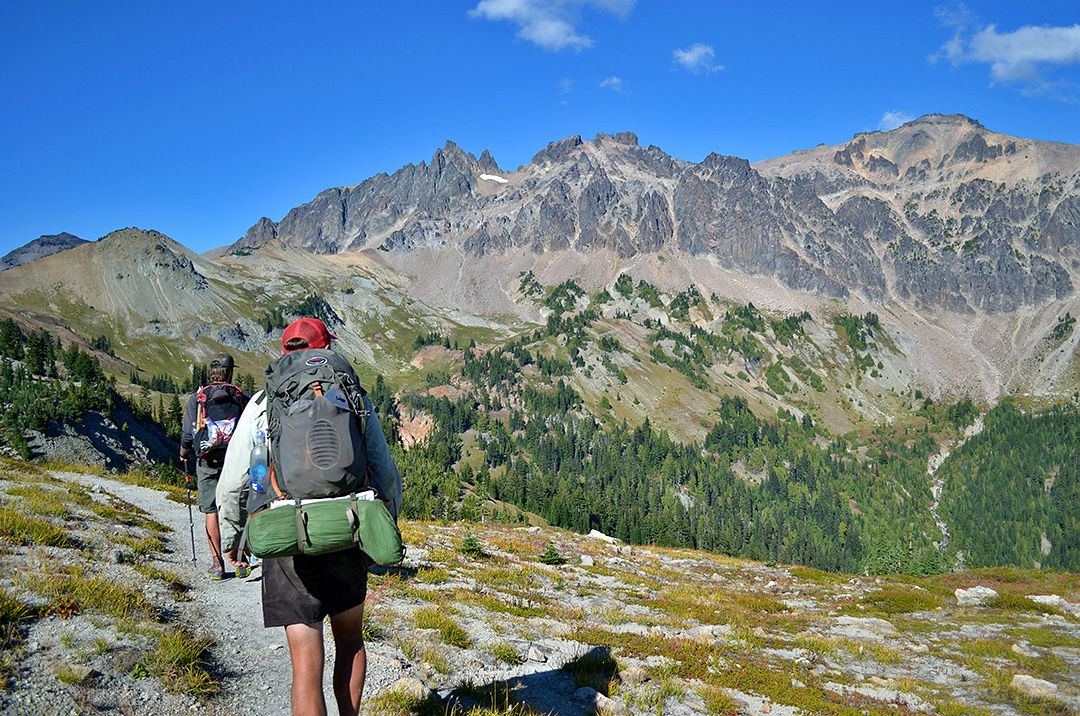
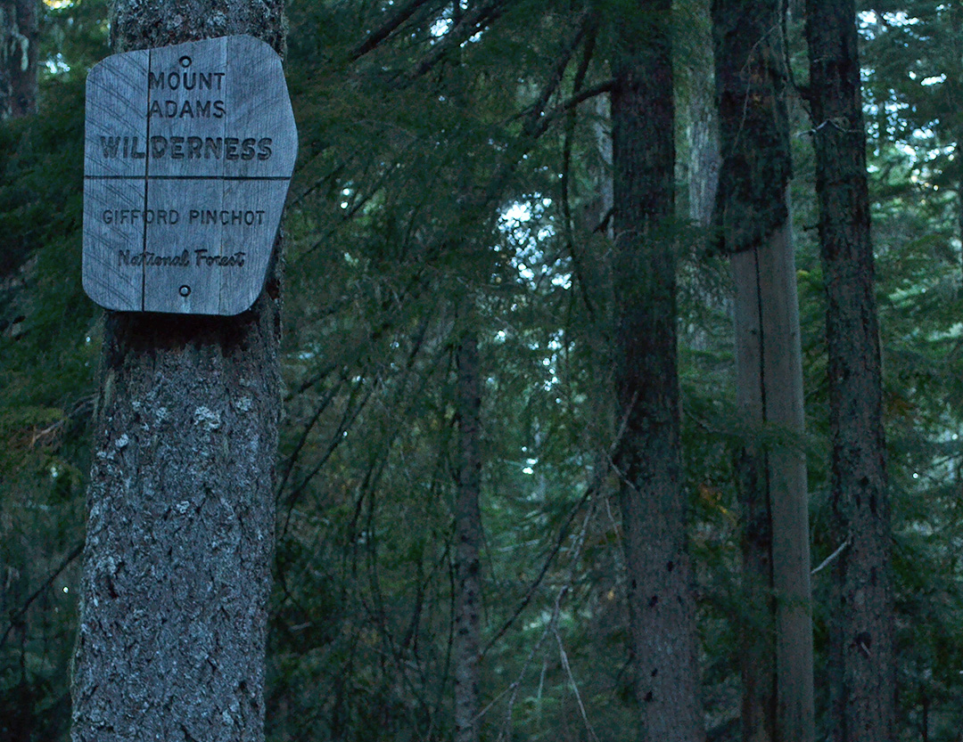
With the well-rehearsed motions and intentions to bag ten before ten (10 miles before 10:00 a.m.), we cruised through the old-growth pines and lush woodlands that define the Gifford-Pinchot National Forest. Sometime during the near 20 miles of trekking prior to meeting the cowboy and his steeds, signified by a half-worn wooden sign on a tree, we crossed into the Goat Rocks Wilderness.
Shortly after departing our horse-backed friend, the colors of autumn lined the trail. I trekked ahead of King Arthur and Snacks as the well-worn path traversed alongside the southwest slope of Gilbert Peak. Navigating across glacial waterfalls and a side slope that put extra weight on my inside trekking pole, the trail made an elongated S-curve up and around the divide, enabling a stunning mountain landscape to bloom .
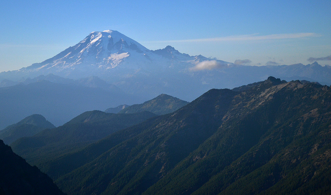
I turned around to see Snacks and King Arthur less than a half-mile behind me. To their backs, the glacial-blue base of Mount Adams we navigated the day before now towered to the south, lending a view of just how far we had traveled in a day. Between Mount Adams dominating the background and the massive boulder garden in the forefront, the value of foot travel really seemed to shine.

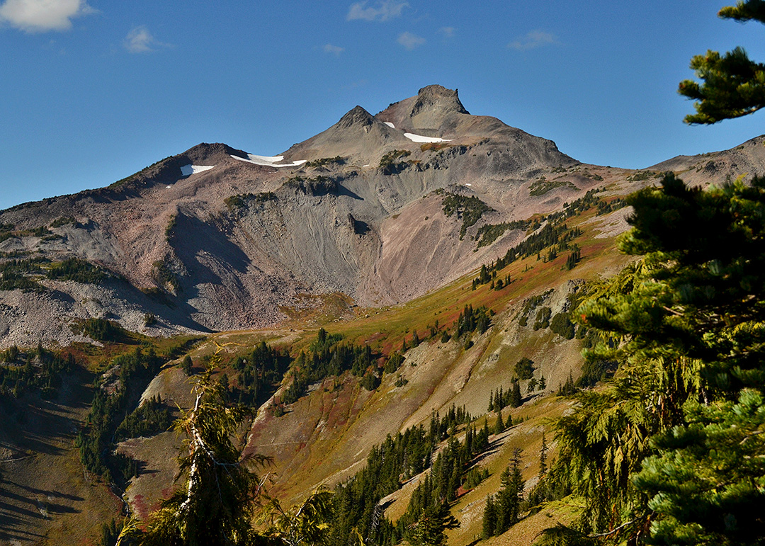
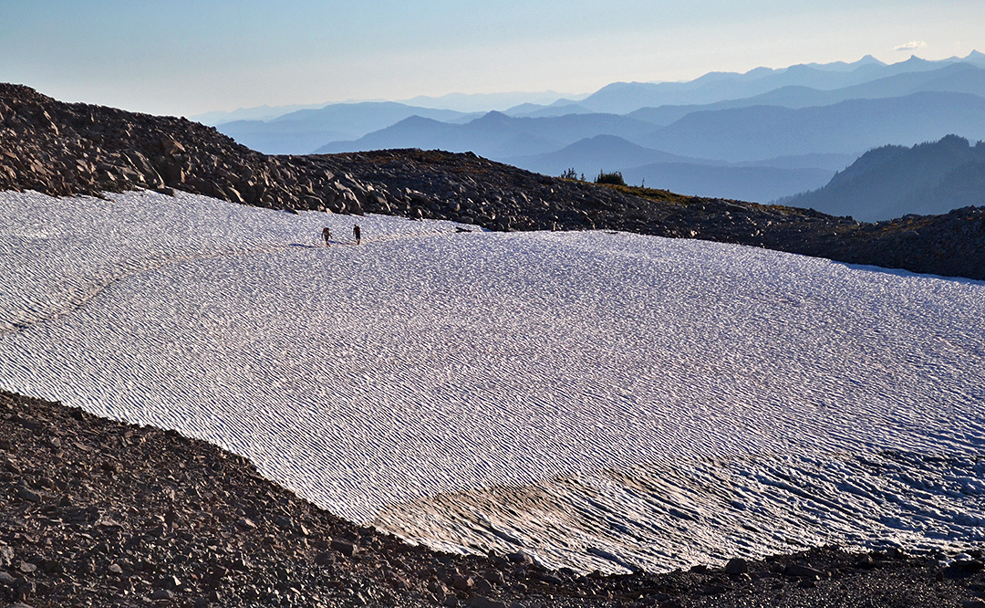
Mount Adams wasn’t the only mountain vying for attention, and the distinct purple-hue of Mount Rainier was shining brighter as the trail moved forward. After crossing a year-round snow patch above tree line, I stopped and waited for King Arthur and Snacks as they navigated through the snow. I wanted to snap some pictures, and more importantly, I didn’t want to tackle the next section of trail alone.
The sun was beginning to set in the distance, casting a cool orange and purple across the sky. We were about to ascend a fabled part of the trail, the Old Snowy Alternative, which had us scrambling up and across a narrow ridgeline comprised solely of hubcap-sized boulders. The rocky outcropping seemed to shift with just the thought of a step, and massive drop-offs lined either side of the route.
A few jokes were cracked as a steam-vent for fear, and as we progressed up the steep incline, the sun smoldered deeper into the horizon. With careful foot placement and a few choice curse words with each unstable step, the three of us were able to catch our breath at the top and enjoy the last bit of the golden hour before it faded to dark.
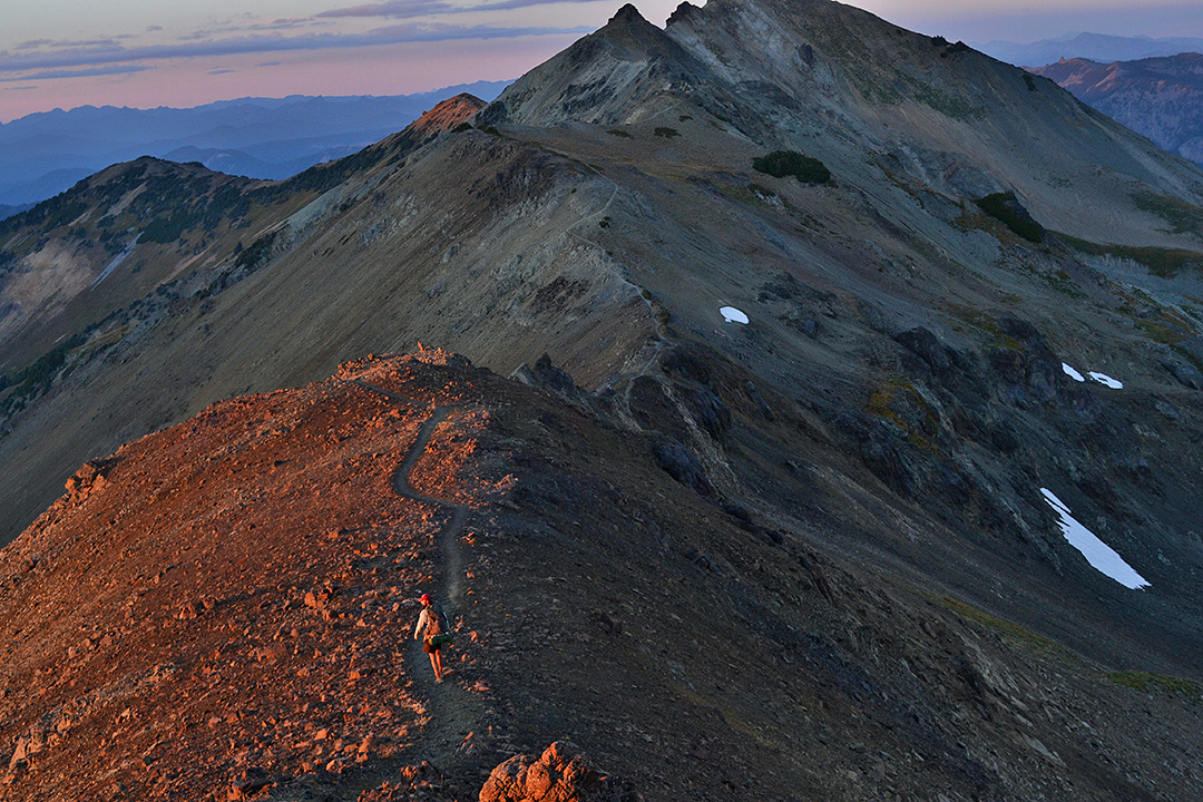
The Old Snowy Alternative within the Goat Rocks Wilderness isn’t only known for its tough ascent and narrow ridgeline features, but sitting at over 7,000 feet and completely exposed, the route also carries a reputation for fast-moving and inclement weather conditions. Without the rain, fog or sleeting snow, however, as we discovered with a lucky enough ascent on a crystal-clear end to the day, the top provides one of those views that can shape who you are.
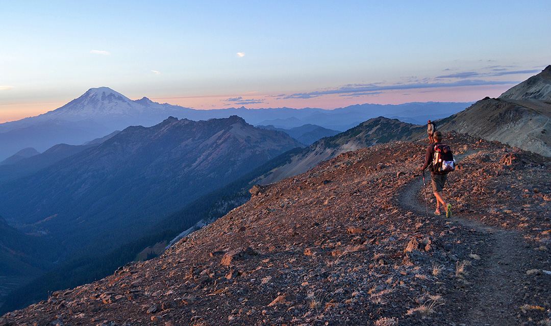
As the sun spread like melted butter over the mountain scene, it brought about both the end of the day and the end to my most beautiful stretch of trail on the PCT. As we pitched tents about a mile down the trail and off the ridgeline, struggling to puncture stakes into the frozen soil, I couldn’t help thinking about the 2,000 of the PCT miles behind me, and how they all added up to this moment here, smelling like a wild animal with a distinct satisfaction in my soul.
